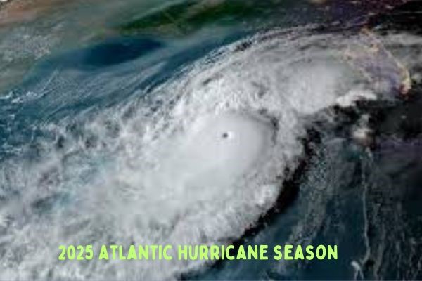
Introduction: 2025 atlantic hurricane season
The Atlantic hurricane season runs every year from June 1 to November 30—six months when the tropics have the right mix of heat and moisture to fuel storms. Historically, the peak falls in late August through early September, with activity usually building toward September 10.
In 2025, the first half of the season has been quieter than expected. So far, we’ve seen four named storms—Andrea, Barry, Chantal, and Dexter—but none have reached hurricane strength. While this might sound like good news, meteorologists caution that the busiest part of the season is still ahead.
Table of Contents
What Forecasters Expected at the Start
Colorado State University’s Early Predictions
Back in April, Colorado State University (CSU) released one of the most closely watched forecasts. They expected:
- 17 named storms
- 9 hurricanes
- 4 major hurricanes
- An Accumulated Cyclone Energy (ACE) index of 155
Their June update kept these numbers, but by July, they lowered them slightly to 16 named storms, 8 hurricanes, and 3 major hurricanes—still an above-average season.
How Other Forecasts Compared
Other meteorological groups also weighed in:
- Tropical Storm Risk (TSR): 14 storms, 7 hurricanes, 3 majors
- University of Arizona: 15 storms, 7 hurricanes, 3 majors
- University of Missouri: 12–16 storms, 7–9 hurricanes, 3–4 majors
- UK Met Office: 16 storms, 9 hurricanes, 4 majors
- Mexico’s National Weather Service: 13–17 storms, 6–8 hurricanes, 3–4 majors
While the numbers vary, most forecasts point toward a more active-than-usual season.
NOAA’s Official Call
On May 22, NOAA predicted:
- 13–19 named storms
- 6–10 hurricanes
- 3–5 major hurricanes
- A 60% chance of above-normal activity
In early August, NOAA slightly revised the outlook to 13–18 named storms, with a 50% chance of above-normal activity and a 35% chance of near-normal activity.
What’s Driving This Year’s Outlook

Warm Waters
Sea surface temperatures in the Atlantic are running unusually warm—around 2°F above the 30-year average. In the Gulf of Mexico and near Florida, waters have reached 90°F, providing extra fuel for storm growth.
Favorable Atmospheric Conditions
Right now, the atmosphere is fairly storm-friendly:
- Neutral El Niño–Southern Oscillation (ENSO) conditions
- Low wind shear, which lets storms develop more easily
- A possible northward shift in the West African monsoon, sending more tropical waves into the Atlantic
Climate Trends
Scientists note that while the total number of storms might not increase dramatically over the decades, the storms that do form could be more intense because of warmer oceans.
Where Things Stand Mid-Season
The Four Named Storms
- Andrea – Short-lived system, no major impact
- Barry – Brought heavy rain to parts of the Caribbean
- Chantal – Stayed over open water
- Dexter – Formed in early August, heading northeast and weakening, but still generating rip currents along parts of the U.S. East Coast
So far, all storms have stayed below hurricane strength.
Areas Being Monitored
In early August, the National Hurricane Center has eyes on several disturbances:
- A low-pressure area off the southeastern U.S. coast – 30–40% chance of development
- A tropical wave in the eastern Atlantic – around 60% chance of development
- Invest 97-L near Africa – low short-term chances, but 60% over a week
August and September: The Critical Window
Historically, mid-August kicks off the most active period of the season. AccuWeather expects 3–5 more named storms in August alone. That means the pace could speed up quickly.
While the early months were slow, forecasters say the warm water and low wind shear could still trigger a burst of tropical activity.
What These Forecasts Really Mean
Why Above-Average Is Still Likely
Even though 2025’s first half has been quiet:
- The peak season hasn’t arrived yet
- Warm ocean waters stretch across the Atlantic and Gulf
- Atmospheric patterns are generally favorable for storms
In other words—things could change fast.
The Preparedness Message
Forecasters emphasize that it only takes one storm making landfall to make a season dangerous or costly. Whether you live in a coastal state or hundreds of miles inland, strong hurricanes can cause flooding, power outages, and wind damage far from the coast.
Final Takeaways
The 2025 Atlantic hurricane season started with fewer storms than expected, but the most dangerous part is just beginning.
- Forecasts still call for above-average activity
- Warm water and favorable conditions mean storm numbers could climb quickly
- The next two months are the most critical for storm formation
If you’re in a hurricane-prone area, now is the time to:
- Review your emergency kit
- Check evacuation routes
- Stay tuned to updates from the National Hurricane Center
When it comes to hurricanes, a slow start doesn’t guarantee a calm finish.